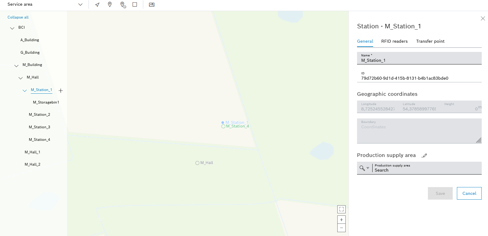
The detailed view of the station appears on the right-hand side and has three tabs.
- Change the Name of the station.
- Create or modify Geographic coordinates.
Assign or remove geographic coordinates for a location - Add a Boundary.
Adding or Editing a Boundary for a Location - Assign a Production supply area.
Assign a production supply area (PSA) to a location
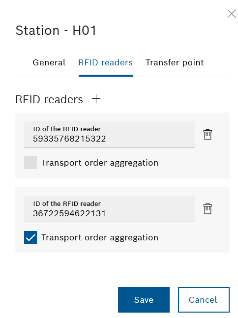
- Add as many RFID readers as required using RFID readers
 .
. - If necessary, adjust the ID in the RFID reader ID text box.
Transport orders can be combined: ![]() Aggregation of transport orders: Transport orders from this station with the same destination are automatically combined in a new transport order.
Aggregation of transport orders: Transport orders from this station with the same destination are automatically combined in a new transport order. ![]() Aggregation of transport orders: Save transport jobs that are scanned with this RFID reader individually.
Aggregation of transport orders: Save transport jobs that are scanned with this RFID reader individually.
Use ![]() next to the ID of the RFID reader text field to delete individual RFID readers. Apply the changes using Save.
next to the ID of the RFID reader text field to delete individual RFID readers. Apply the changes using Save.
Different coverage areas meet at a transfer point and goods can be exchanged.
Coverage areas must be created under Maps > Coverage areas in order to be able to select them for a transfer point.
Supply Areas
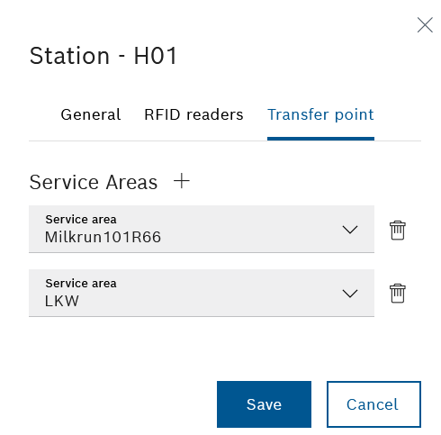
- Add coverage areas with Coverage areas .
At least two coverage areas must be specified for a transfer point.
- In the Coverage area drop-down lists, select the desired coverage area.
- To delete a service area, click
 next to the relevant drop-down list.